
Page 20 - IB May 2018 Edition
P. 20
Climate Change
The work he said, potentially has sig-
nificant implications for Tuvalu. They now
have a high resolution understanding of
how the islands are physically changing.
Kench said the information is critical
to support land use and development
decisions and adaptation decisions of the
government.
For example, the information could be
used to show which islands are most sta-
ble, or expanding, which might be the best
sites to explore for development purposes.
In contrast those sectors of shoreline that
are eroding fastest could be identified and
ensure that activities are kept away from
these sensitive sites.
The study report left Tuvalu Prime Min-
ister Sopoaga fuming however and he has
since labelled the study as “flawed.”
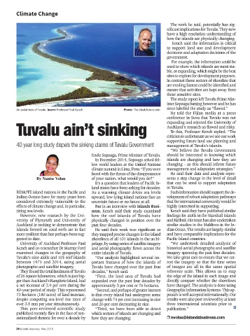
An aerial view of Tuvalu. Insert: Professor Paul Kench. Photo: The bleak future.com
He told the Fijian media at a press
conference in Suva that Tuvalu was not
Tuvalu ain’t sinking Auckland’s research as flawed and risky.
expanding and rejected the University of
To this, Professor Kench replied: “The
criticism is unfortunate as we see our work
supporting future land use planning and
40 year long study dispels the sinking claims of Tuvalu Government management of Tuvalu’s islands.
“We believe the Tuvalu Government
Enele Sopoaga, Prime Minister of Tuvalu. should be interested in knowing which
In December 2014, Sopoaga asked fel- islands are changing and how they are
low world leaders at the United Nations changing – as this should inform future
climate summit in Lima, Peru: “If you were management and adaptation strategies.”
faced with the threat of the disappearance He said their data and analysis repre-
By Nanise Volau of your nation, what would you do?” sents a step change in the level of detail
It’s a question that leaders of Pacific Is- that can be used to support adaptation
land states have been asking for decades. in Tuvalu.
REMOTE island nations in the Pacific and As a warming climate drives sea levels Such information should support the de-
Indian Oceans have for many years been upward, low-lying island nations face an velopment of robust adaptation pathways
considered extremely vulnerable to the uncertain future or no future at all. that the international community would be
effects of climate change and, in particular, But in an interview with Islands Busi- highly interested in supporting.
rising sea levels. ness, Kench said their study examined Kench said they have published similar
However, new research by the Uni- how the reef islands of Tuvalu have findings for atolls in the Marshall Islands
versity of Plymouth and University of physically changed in position over the and Kiribati. His team has also undertaken
Auckland is seeking to demonstrate that past four decades. similar studies in the Maldives in the In-
islands formed on coral reefs are in fact He said their work was significant as dian Ocean. The results are largely similar
more resilient than has perhaps been sug- they mapped precise changes in the island and have comparable implications for the
gested to date. shorelines of all 101 islands in the archi- Pacific Island countries.
University of Auckland Professor Paul pelago, by using series of satellite imagery “We undertook detailed analysis of
Kench and co-researcher Dr Murray Ford and aerial photography flown across the historical aerial photographs and satellite
examined changes in the geography of entire islands of Tuvalu. imagery spanning the past four decades.
Tuvalu’s nine atolls and 101 reef islands “Our analysis highlighted several im- We take great care to ensure that we cor-
between 1971 and 2014, using aerial portant features of how the islands of rect the imagery so that the time series
photographs and satellite imagery. Tuvalu have changed over the past four of images are all in the same spatial
They found the total landmass of Tuvalu decades,” Kench said. reference scale. This allows us to map
of 26 square kilometres, which is just big- “First, the land area of Tuvalu had the edge of the island in each image and
ger than Auckland’s Rangitoto Island, had expanded over the past four decades by directly compare whether the shorelines
a net increase of 2.9 per cent during the approximately 3 per cent or 76 hectares. have changed. The analysis is done using
40-year period of study. This represented “Second, and perhaps of greater interest Geographic Information Systems. This ap-
73 hectares (180 acres) of land increase, is that every island had undergone some proach is well accepted internationally. Our
despite competing sea-level rise rates of change with 74 per cent increasing in size results were also peer reviewed by at least
over 3.5 mm per year simultaneously. and 26 per cent decreasing in size. three international scientists prior to
This peer-reviewed scientific study “Third, we have been able to detect publication.”
published recently flies in the face of sen- which sectors of islands are changing and
sationalised rhetoric for over a decade by how they are changing. r nvolau@islandsbusiness.com
20 Islands Business, May 2018