
Page 12 - IB May 2018 Edition
P. 12
Weather
Cyclone Keni.
As the system tracked closer to the
southwest of Viti Levu, Fiji’s main island,
a blind spot was created as weather fore-
casters could not see where it was headed.
On that day, one weather bulletin said
TC Keni would make landfall between the
two towns of Nadi and Sigatoka, while an
hour later, a second weather bulletin said
it would not make landfall.
“The Nausori radar picked it up but by
that time the “eye” of the cyclone was
already getting close to Kadavu,” Prasad
said.
People on Kadavu were not able to be
informed in time that TC Keni was coming
right at them.
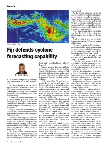
Satellite image of TC Keni
“Improvements in model predictions
Fiji defends cyclone and forecasts will of course require greater
investment in meteorological observations
on the surface, at various levels of the
forecasting capability atmosphere and at sea,” said Prasad.
He said ships out at sea used to play
a pivotal role in assisting Fiji Met with
weather forecasting.
“There has been a massive decline in
but it finally passed right over Kadavu,” the number of weather observations from
he added. ships over recent decades which has af-
Weather forecasts that are unable to fected weather analysis in the vast oceanic
precisely say where a severe weather regions of the Pacific.”
system is heading causes confusion. And Weather forecasters have to factor in
in this day and time of social media, panic a degree of uncertainty when it comes to
By Anish Chand is created when citizens read the wrong issuing a cyclone warning. Of all natural
information from un-credited weather disasters, cyclones can be predicted and
WEATHER forecasting is a huge challenge websites. warnings given quite ahead of time.
and at most times mixed with complica- “While some of the TC track and in- If data is not read correctly, un-expe-
tions. tensity changes are part and parcel of the rienced weather forecasters will issue an
The former Director of the Fiji Metro- behavioural aspect of a tropical cyclone over-warning for some areas and under-
logical Services, Rajendra Prasad said (or any other weather system), providing warning for other areas.
forecasters try their best to lock in the so fine forecasts at very early stages, and “While this is part and parcel of the
correct report by looking at weather model then changing tracks so often, causes hazard detection and warning process,
predictions. But these models are not often confusion and doubt among people who asking people to close down operations
accurate enough. may eventually lose confidence in the and prepare too early can be quite costly
“It should be common knowledge that warnings,” said Prasad. especially for those that have been over-
numerical weather prediction models do The Nadi Weather Office has admitted warned,” said the former head of Fiji Met.
rather poorly in this part of the world that its weather radar at Nadi was not The recommended strategy is to draw
compared to other tropical cyclone basins operational. Current Director of Fiji’s Me- peoples’ attention. This should be done
and so relying on them can be very risky,” teorological Services, Ravin Kumar said through a more general warning at initial
said Prasad. the weather office only has two radars; one stages and trim or narrow down to likely
Giving an example of the recent Tropical in Labasa in Fiji’s north and the other in areas to be hit as the tropical cyclone draws
Cyclone Keni, Prasad outlined how Fiji Met Nausori, near the capital, Suva. nearer and track forecasting improves.
may have failed to forecast its correct track “The radar in Nadi is undergoing an “Forecasters may get tempted to believe
and impact areas. upgrade this month for which government model forecasts too ahead of time and
“The models were bringing TC Keni very had allocated $1.8 million (US$887,000). consequently give forecasts that can have
swiftly onto Fiji right from its formation Rotuma is also earmarked to have a new large uncertainties,” said Prasad.
stages. As a result, the initial prediction radar soon,” Kumar said. Based on his experience, Prasad said the
was for it to start affecting Fiji from Sun- Though Fiji Met would not admit it, the way to do it for forecasters was to avoid
day, which was then changed to Monday absence of radar in Nadi creates a blind- talking about threat from a tropical cyclone
and subsequently to Tuesday when it spot for a couple of hours when a tropical that has not developed. The former Fiji Met
finally hit,” he said cyclone system or tropical depression ap- Director believes weather bulletins issued
“The initial model forecast was for proaches the Fiji group. by Fiji Met are still quite technical and dif-
its centre to pass significantly south of The radar in Nadi, which has been out of ficult for an average person to understand.
Kadavu, then close to Kadavu and later service for some time, would have helped He said during his time, a more plain
on even touching on southern Viti Levu, in precise location and tracking of Tropical language text was issued after each special
12 Islands Business, May 2018